Newberry Springs Abandoned Homes
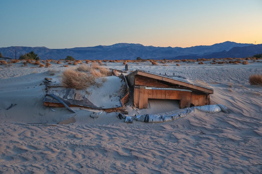
Environmental conditions of an intermittent river, combined with the unforeseen results of road maintenance ignited a slow, nightmarish scenario for several residents who saw their homes buried in drifting sand in a small Mojave Desert town.
The Mojave River flows for 110 miles, originating on the northern side of California’s San Bernardino Mountains and typically ending in a basin at the edge of the Mojave National Preserve. The majority of the river flow is beneath the surface, though unusually wet periods will lead to the river surfacing along a larger portion of its course, as well as its terminus stretching further to reach the normally dry Soda Lake near the remains of the former Zzyzx Mineral Springs community or Silver Lake to the north of the town of Baker.
Most of the river’s route courses through the Mojave Desert region, an area often seen as a cast off landscape of eastern California that lies distant from any popular destinations aside from food or gas stops along the drive to Las Vegas or Arizona. However within this supposed flyover terrain lies the ongoing drama and partially buried effects of shortsighted decisions and a slow enveloping destructive process that forced some of those who called the area home to move away.
The Mojave River cuts through the town of Newberry Springs, visible by a path of sand across the landscape. Newberry Springs as a whole is a town on the decline – with its commercial locations along historic Route 66 losing nearly all traffic with the late 1950’s completion of Interstate 15, the closure and decay of nearby tourist attractions such as Rock-A-Hoola Waterpark at the town’s fringes, and many of the homes in town being the refuge of a populace just seeking a quiet corner of the desert in which to be left alone.
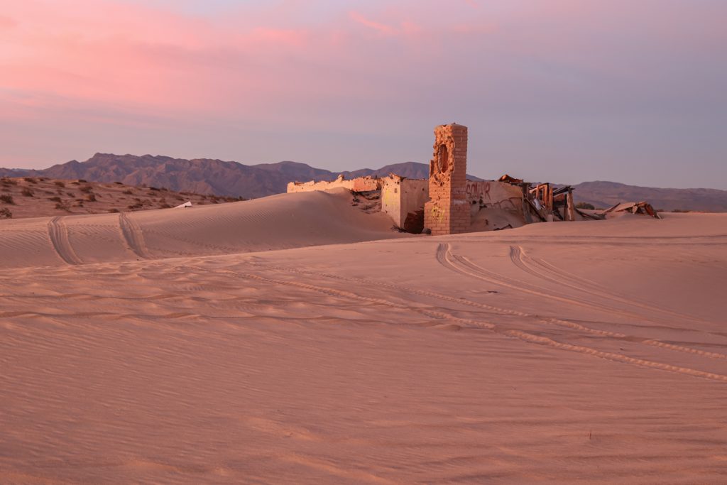
Following the completion of the interstate, Newberry Springs could be divided into two areas, the older homes and neighborhoods along Route 66 on the south side of the Mojave River, and a few properties fronting the route of I-15 on the north side of the river. Only two roads cross the river’s sandy surface, and these roads are prone to seasonal closures during wet conditions when the water reaches the surface and floods the sandy channel, washing over the two-lane asphalt bands.
Beginning in 1979, after winds would blow sand across Minneola Road, one of the two cross-river paths, San Bernardino County maintenance crews would collect the sand and dump it on the downwind side of the road. During this time, residents who lived in homes further downwind began noticing the constant accumulation of sand on their properties. Some of the residential lakes created from pumping the underground river water to the surface – so prevalent and large in the area that some were and still are used to train waterskiers – began to fill with the endless roaming particles, while other homes would construct walls and barriers to protect against the walls of sand that would gather and build on their windward sides.
Following waves of complaints, the county ceased the practice of removing and dumping sand in 1991, however other conditions had taken hold – including the increasingly widespread pumping of groundwater that led to more dry sand in the area, and local utilities installing lines which further unsettled the river floor. As the sand dunes moved migrated downriver, more residents would talk of the sand particles entering their homes through any opening, leaving surfaces covered in dust after short periods of time, rendering electronics damaged and useless, and costing thousands of dollars in useless attempts to hold back the endless flow of sand.
Residents joined together in a lawsuit against the county, however the county sued other entities in attempts to disperse the blame for the sand ultimately forcing people from their homes and leaving the properties essentially valueless.
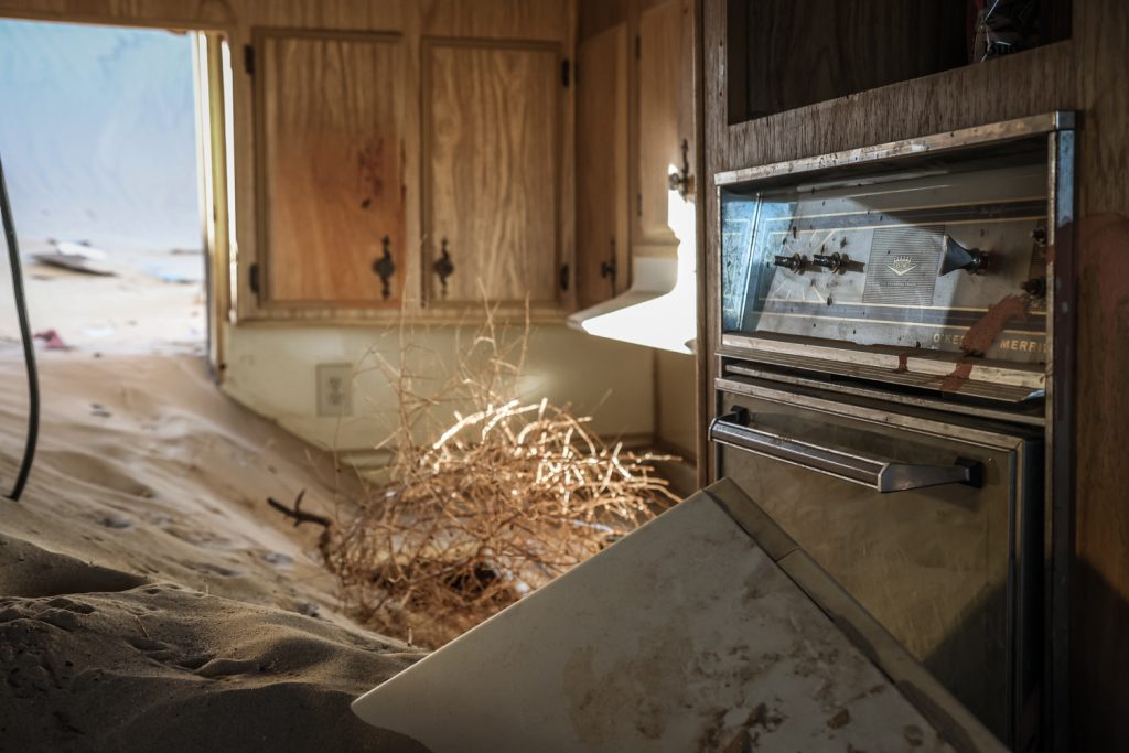
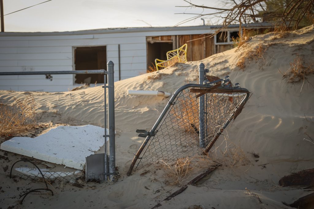
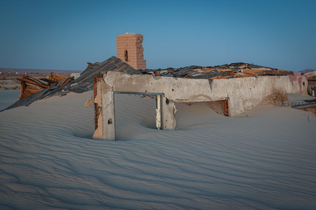
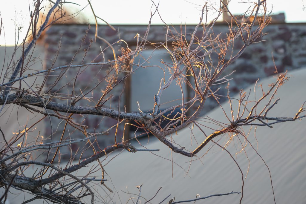
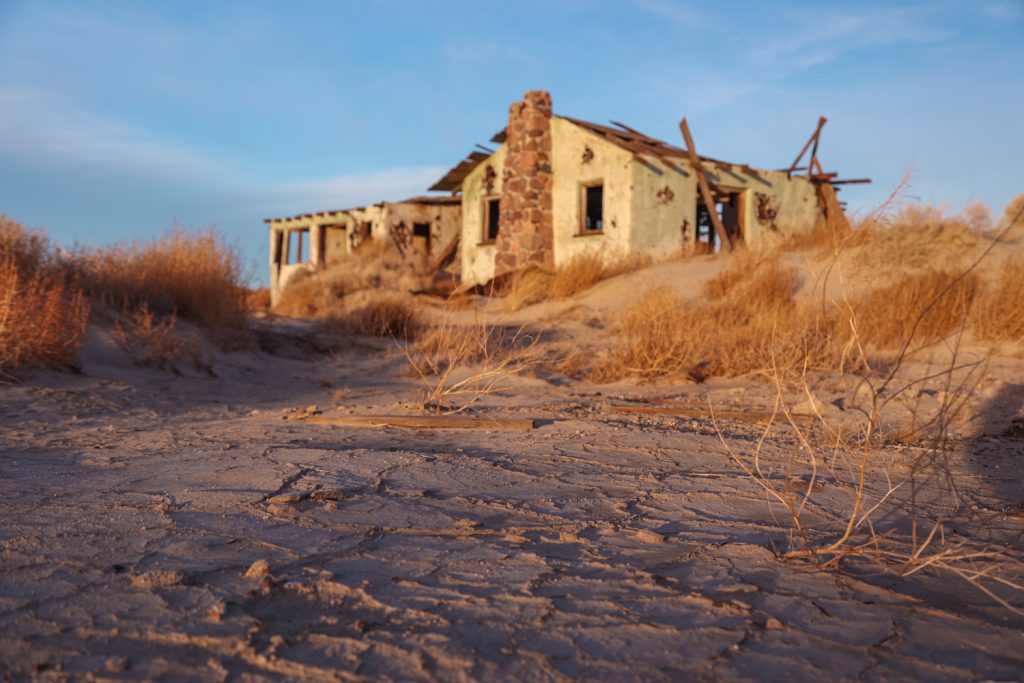
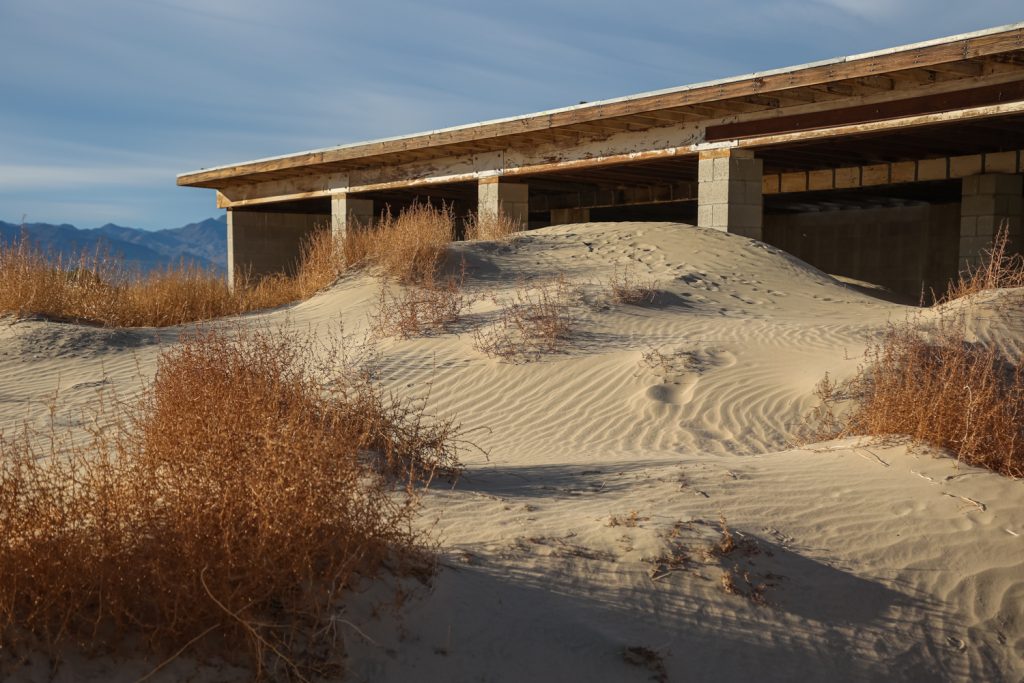
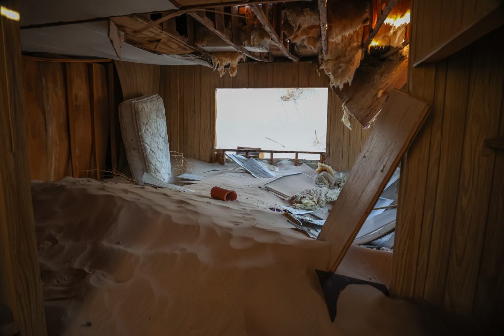
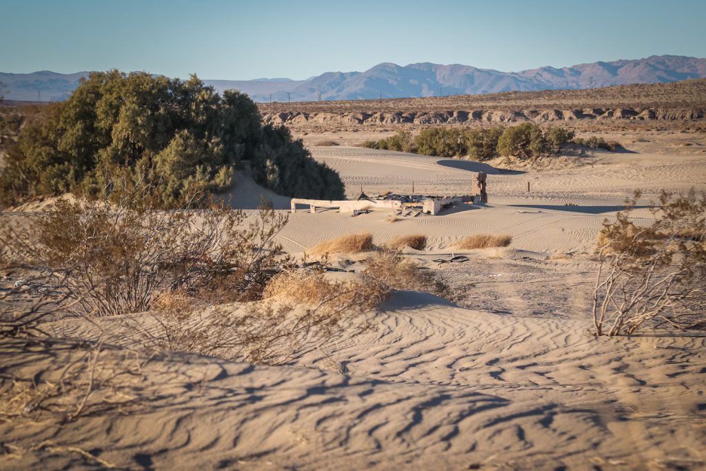
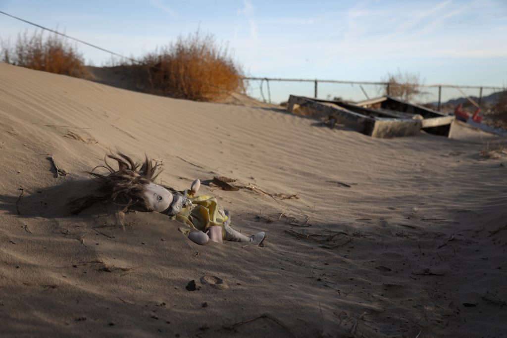
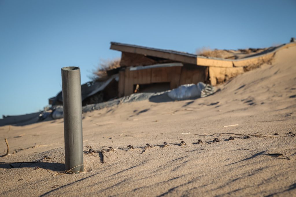
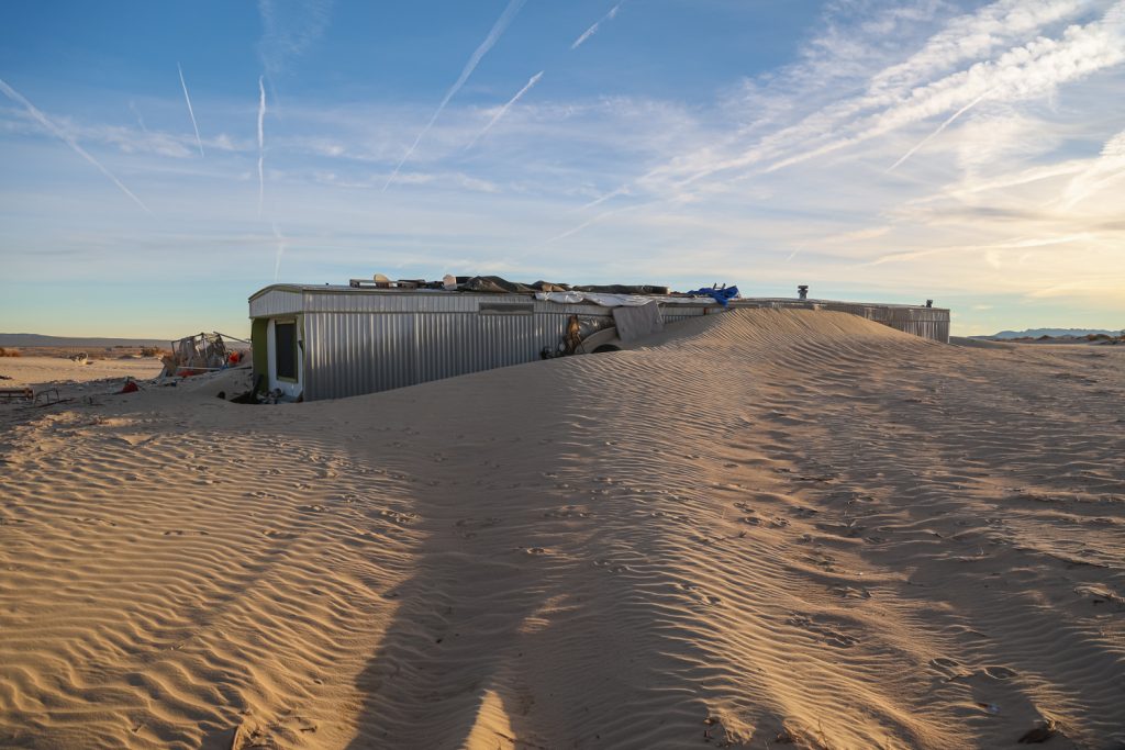
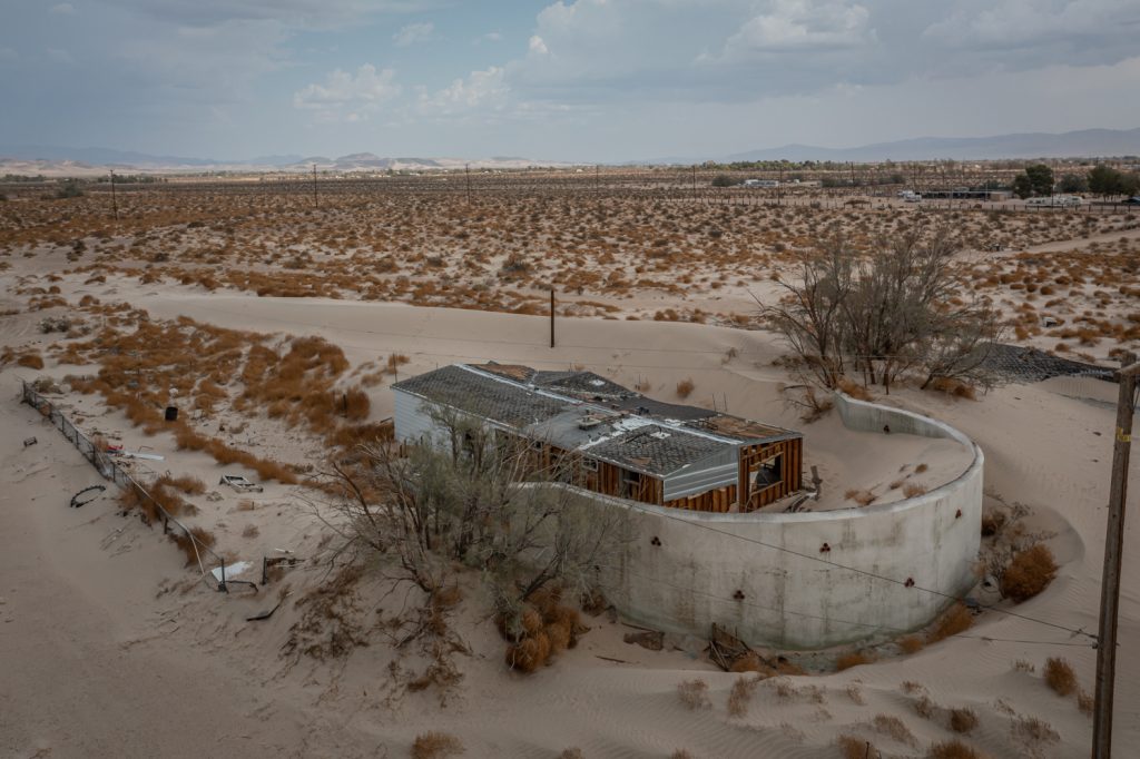
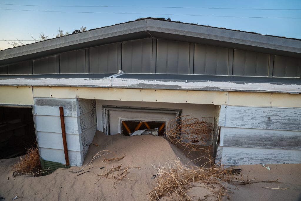
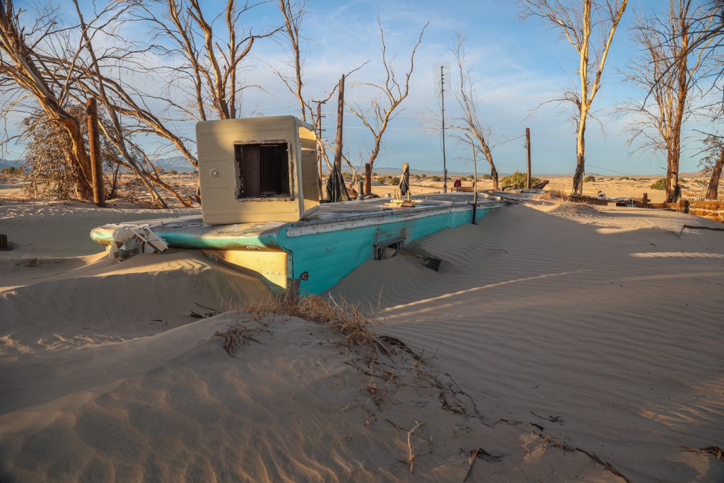
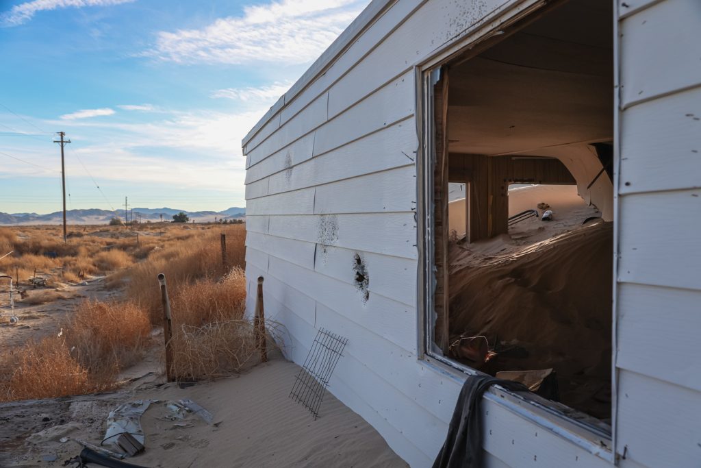
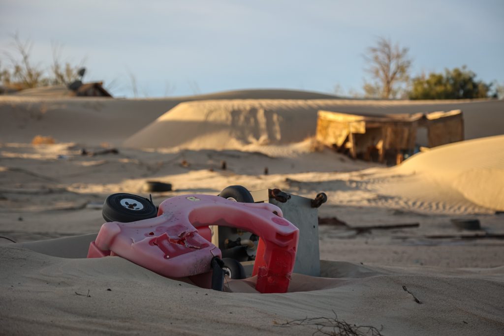
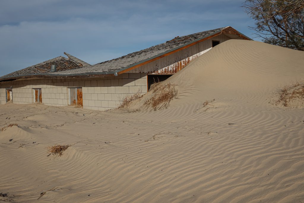
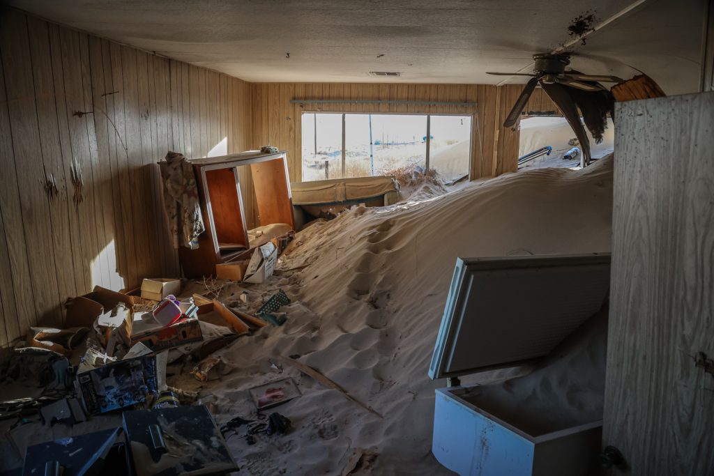
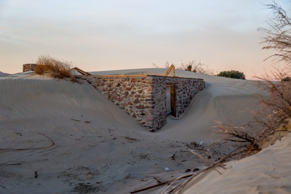
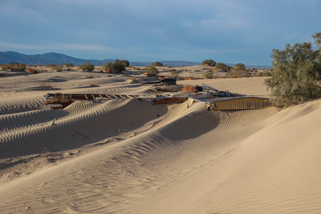
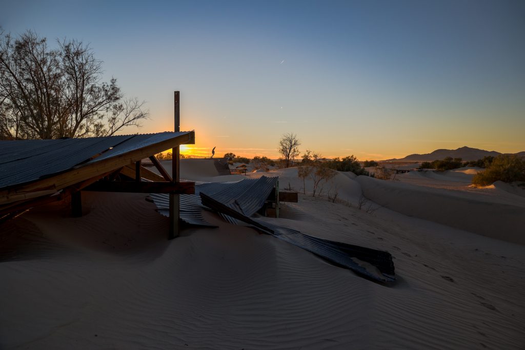
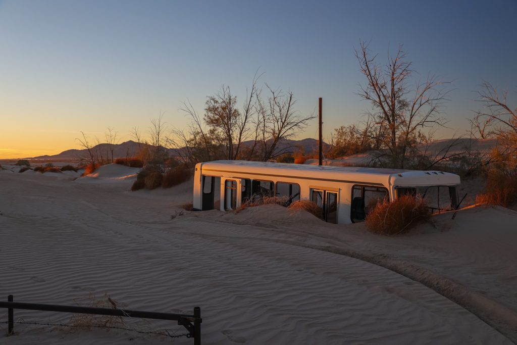
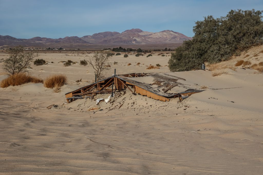
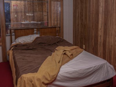
These days, several of the abandoned homes of Newberry Springs still sand, some with their defenses against the sand visible – walls, fencing, trees – though sand dunes towering up to 20 feet tall cover these fortifications, and much of the homes and vehicles themselves. What remains are signs of those who were eventually given no option but to walk away from their homes. Children’s toys lay in the sand, while the interiors of buildings cannot be entered, some brimming to the tops of their walls with solid piles of sand. In others, mattresses and appliances lay partially buried.
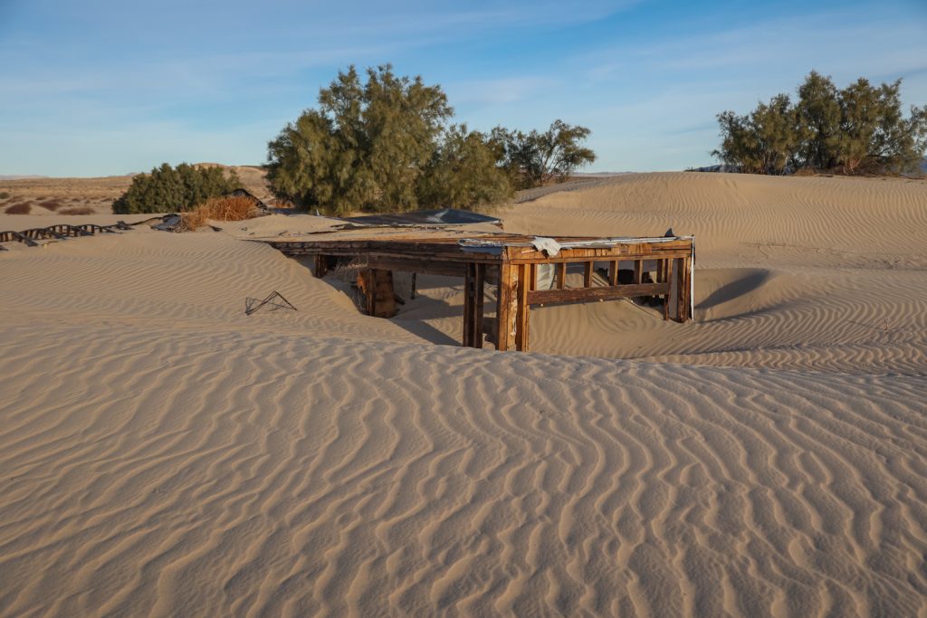
The Mojave River continues to flow past just a short distance from these homes, still under the surface except after the wettest conditions. But from an overhead perspective, it’s clear to see that the dunes have spread beyond the edges of the river’s course. Sheets of sand and a constantly fluid movement of dunes cover and uncover the remains of the structures in its path. The shifting nature of the sand leaves the abandoned homes and buildings in a varying and changing state of being buried. However to step inside of a home and see the sand piling up to its countertops and its roof collapsing from the weight of sand collected above it is to realize the nightmare of living in a place that is taken over and destroyed slowly, to have all of one’s possessions damaged by the sand particles that will infiltrate even the smallest opening. Then to walk outside and around the building and see the sand piled to the tops of doorways and windows – a view at the elapsed years of the dune’s movement and what each property in the sand’s path would ultimately look like, regardless of the short term barriers and attempts at saving the homes made over the decades – it brought the feeling home.
The abandoned homes of Newberry Springs remain, with residents having stayed until the early 2000’s. Meanwhile other homes are still lived in, though to keep the asphalt streets to the homes drivable and free of the drifting sands remains an ongoing effort.
Lying mostly ignored and localized, there are few media mentions or attention on the long since gone residents and the structures which continue their slow deterioration in the Mojave sun. One good article that captures the area in the midst of the unfolding of the lawsuits and abandoning movement away from the area is this Los Angeles Times article, published in 1993.
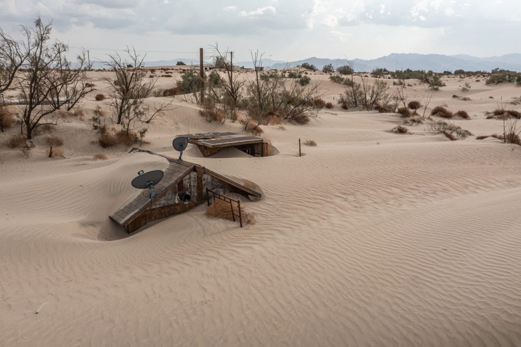
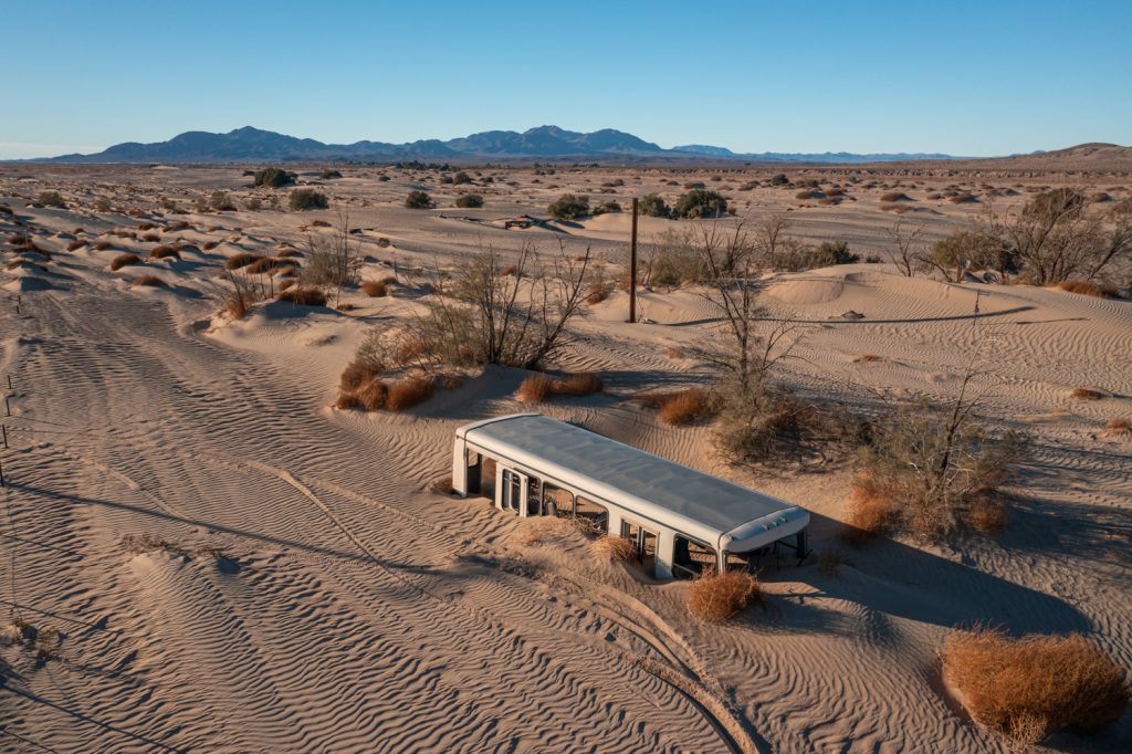
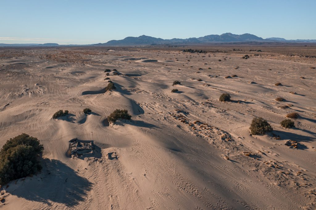 Endless… The surface of the Mojave River with one home pictured bottom left.
The home you took the most photos of me and my family lived in until almost 2011, the sand has reclaimed the land it seems
Wow did y’all really? Did you leave things behind? I explored there recently and it’s incredible some of the things left inside including food, old school or grad photos. All sorts of things strewn about in the yard perimeters from floods I assume.
Wow, what a story. Great article and great pictures. I would love to see a documentary on this it would be interesting to hear some testimonies.
Very beautiful documentation. A tale of lives slowly blown away. I'd love to go here, do you have coordinates?
Do you have driving directions from Route 66 or I-40? Thanks.